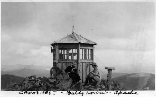
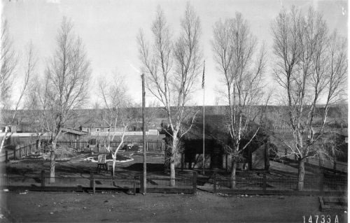
www.flickr.com/photos/swregion/sets/72157626279029972/n.d. - Lookout (the "Crow's Nest") on Mt. Baldy. Solid as the Rock of Gibraltar, the lookout foundations were sunk in cement and the cab was guyed on all six sides. 1912 - The Apache Forest Supervisor's Office. In the original photo, the words "Apache National Forest" can be read on the door, painted in white letters. Note the weather station in the yard.
FS #147333
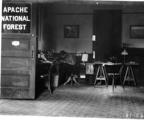
1912 - Interior of the Apache office headquarters in Springerville, Arizona.
FS #14700
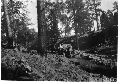
1912 - A little water for the radiator. Another stretch of 10% road: Fish Creek Road within the Apache National Forest.
FS #14719
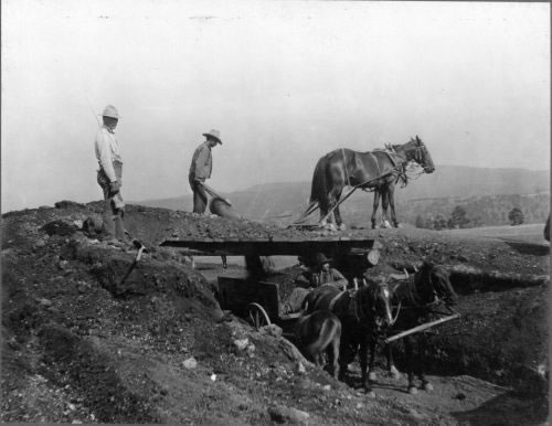
n.d. - Construction work on the Ocean to Ocean Highway between Springerville and Sheep Springs. This was a 10% job. Ten percent of annual forest revenues were allotted for road construction on the forests.
Photo by T. S. Woolsey - FS #2846
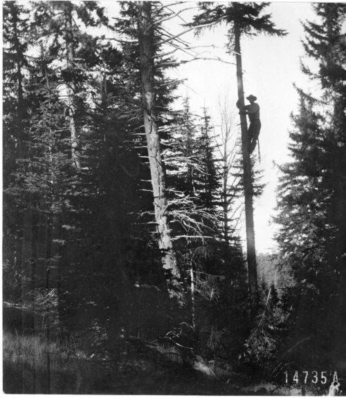
1913 - Telephone line construction in the Blue Range. The "tree line" construction technique was used. The wire was strung between two living trees rather than on cut poles. At this early date, the line was probably a single-wire "ground-return circuit."
FS #14735
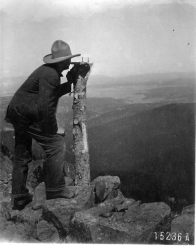
1913 - Lookout Guard D. W. Eager sighting a fire with alidade and protractor. Eager is at 11,200 feet Lookout Point on top of Baldy Mt.
FS #15236
1919 - A segment of road work on the Ocean to Ocean Highway. Cutting into a rocky slope between Springerville and Sheep Springs.
Photo by T. S. Woolsey - FS #2849
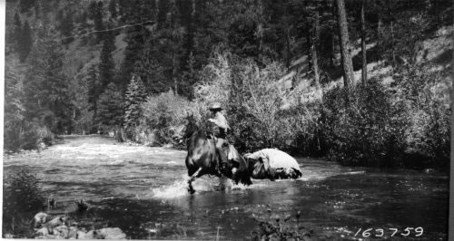
1921 - Crossing Buffalo Fork, Black River, below Three Forks on the Apache National Forest.
Photo by C. K. Cooperrider - FS #163759
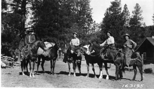
1921 - Field party on a sheep damage examination trip. The group was photographed along the Heber-Reno sheep driveway on the Sitgreaves National Forest.
Photo by P. H. Roberts - FS #163195
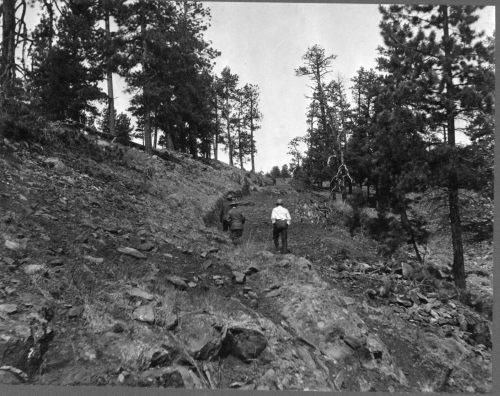
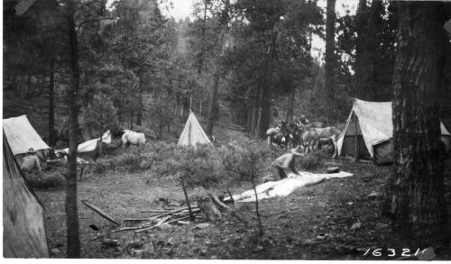
1921 - The Red Hill trail crew breaking camp.
Photo by P. H. Roberts - FS #163210
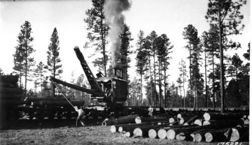
1922 - Loading a railroad car on an Apache Lumber Company sale.
Photo by P. H. Roberts - FS #175221
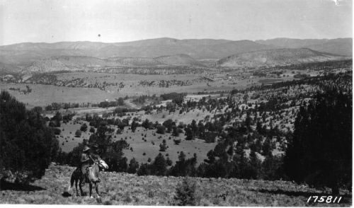
1923 - Reserve Valley, Apache National Forest. District (Regional) Forester Pooler is in the foreground.
Photo by E. W. Kelley - FS #175811
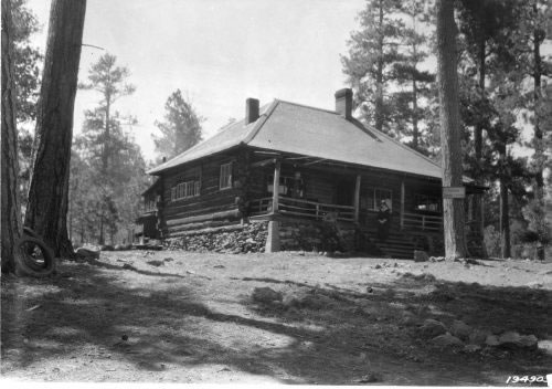
1924 - Riverside Ranger Station at Greer, Arizona. When transportation was slow and difficult, the Forest Service needed many small Ranger Stations, like this one. Improvements of roads and rigs lead to consolidations of both Ranger Districts and National Forests.
Photo by G. H. Cook - FS #194905
1924 - A camp in Black Canyon.
Photo by Q. Randles - FS #187702
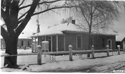
1926 - Apache Forest Supervisor's Office in Springerville, Arizona. This is one of several locations in Springerville that have been used as headquarters for first the Apache and then the Apache-Sitgreaves.
Photo by K. C. Kartchner - FS #217482
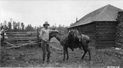
1926 - W. B. Ramsel with a freshly killed bear at Reservation Ranch.
Photo by K. C. Kartchner - FS #217472
1936 - "Sheep Crossing," a well-known point in the early days on the Upper Colorado River.
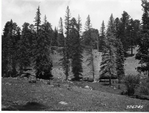
Photo by R. King - FS #325245
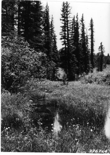
1936 - A pool on the East Fork of the Little Colorado.
Photo by R. King - FS #326264
1937 - Trucking logs to a small sawmill.
Photo by R. King - FS #347237
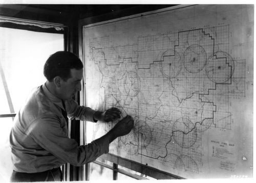
1939 - Big Lake Lookout locating a fire by triangulation on the Apache fire map.
Photo by W. H. Shaffer - FS #383794
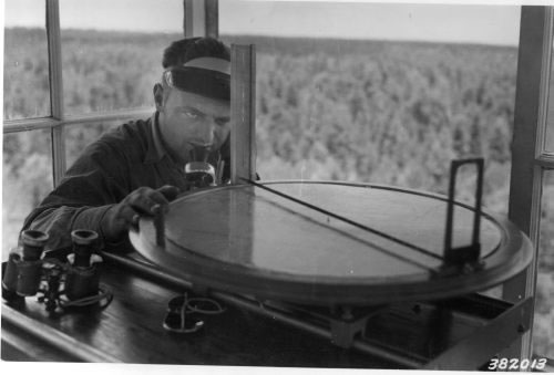
1939 - Mr. Burr Webb, lookout at Promontory tower, sights through the Osborne fire-finder.
Photo by W. H. Shaffer - FS #382013
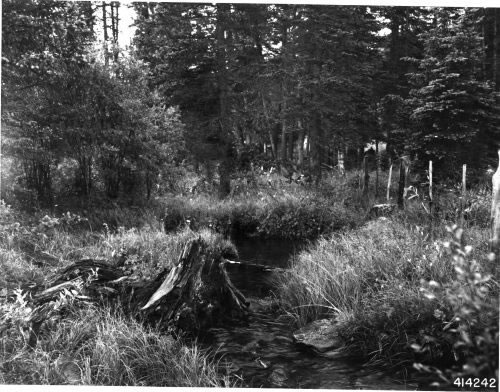
1941 - Upper end of Little Colorado River in Phelps Natural Area. Considered to be virgin conditions of vegetation.
Photo by R. King - FS #414242
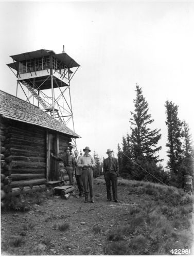
1942 - Lee Kirby, Wes Knorpp, Dick Lewis, and Gordon Bade at Green Peaks Lookout. The lookout is an Aermotor type MC-24.
Photo by F. L. Kirby - FS #422981
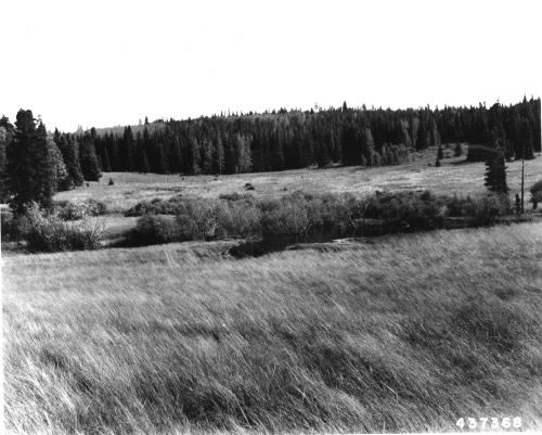
1945 - Virgin range, Phelps Natural Area.
Photo by R. King - FS #437368
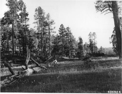
1945 - Grassy opening in draw in ponderosa pine.
Photo by R. King - FS #436924
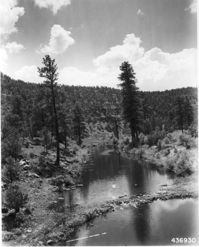
1945 - Chevelon Creek, seen from the bridge on Mormon Crossing Road.
Photo by R. King - FS #436930
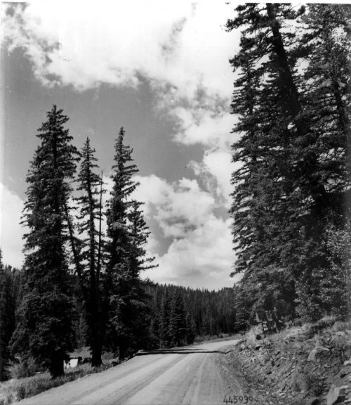
1947 - Entrance to Sheep Crossing Recreational Area on the Little Colorado River.
Photo by R. King - FS #445939
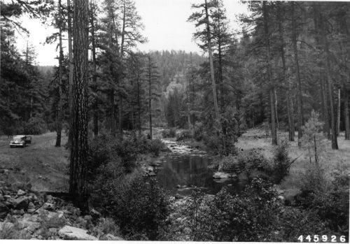
1947 - East Fork of the Black River below Diamond Rock Lodge.
Photo by R. King - FS #445926
1947 - The Horseshoe on East Fork of Black River below Three Forks.